Introduction
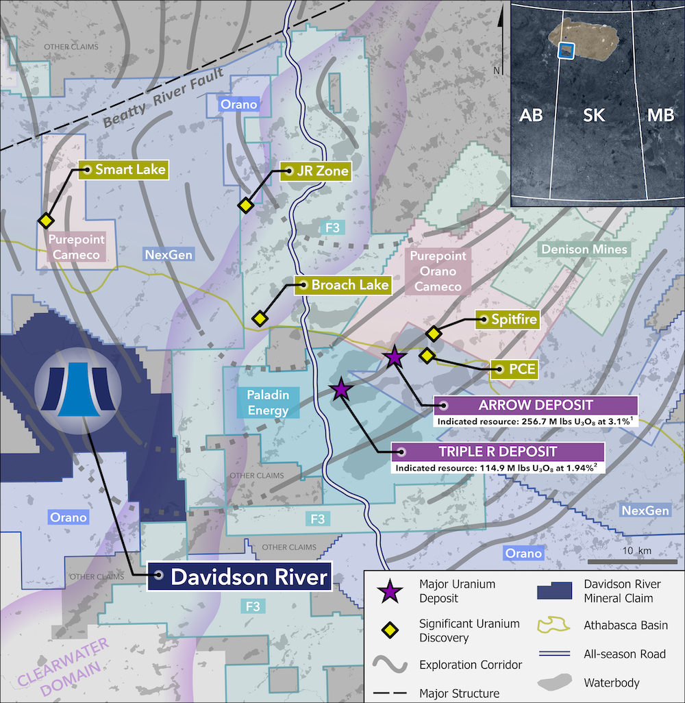
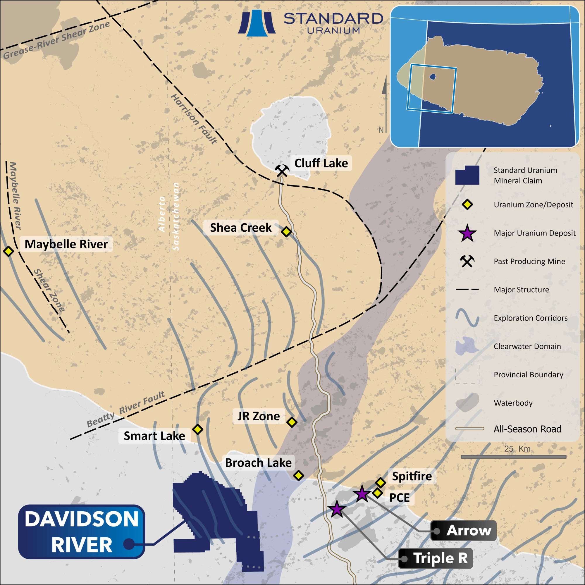
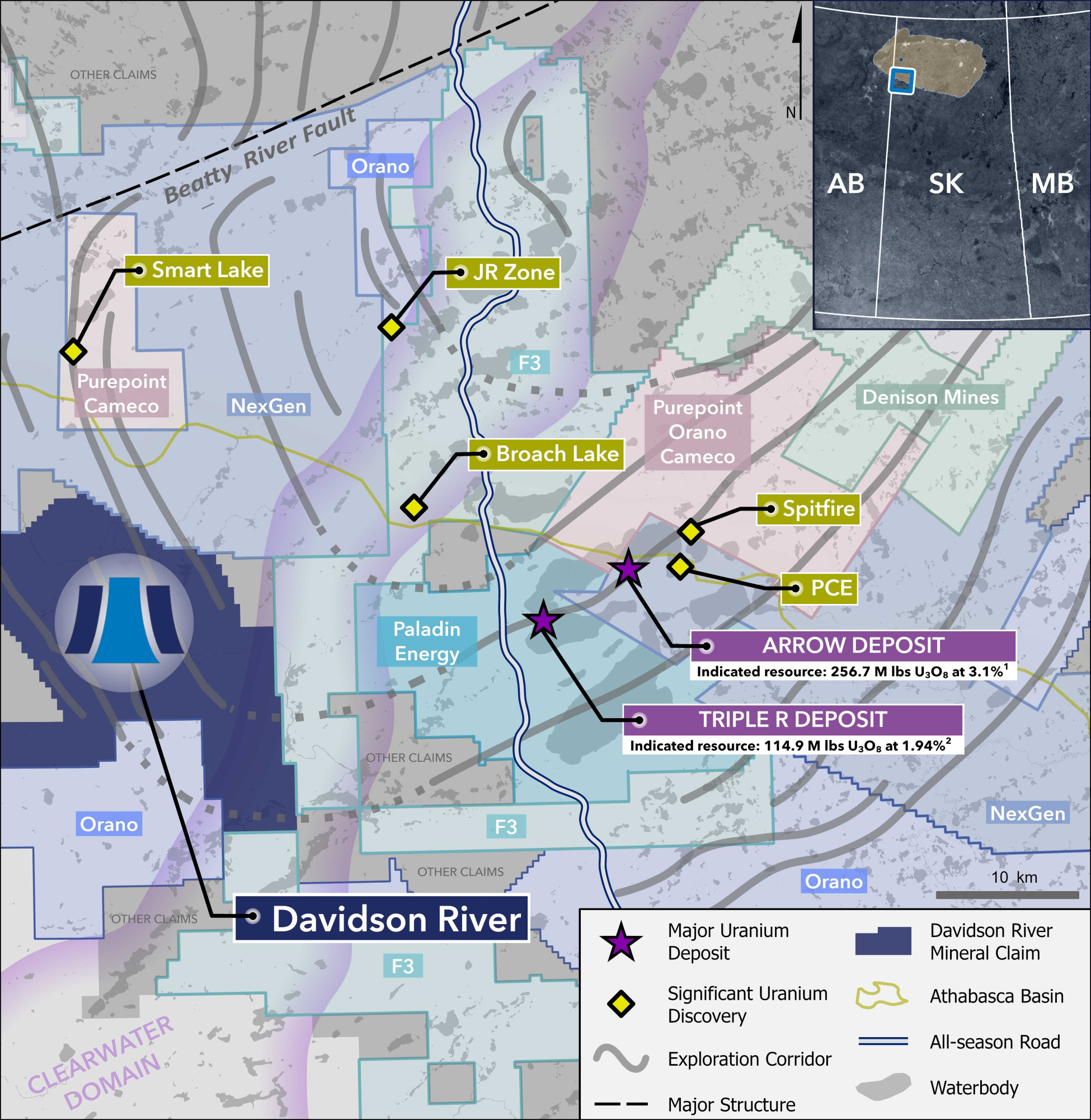
Davidson River is Standard Uranium’s flagship asset in the Southwest Athabasca Uranium District of northern Saskatchewan. The project covers the interpreted extension of the same prolific structural corridors that host two of the sector’s most significant discoveries - Paladin Energy’s Triple R deposit and NexGen Energy’s Arrow deposit - positioning Davidson River geologically along trend from more than 430 million pounds of known high-grade uranium. This district continues to yield new discoveries as modern geophysics, refined structural models, and exploration drilling systematically unlock additional high-grade zones, underscoring the ongoing potential for major resource growth.
Southwest Athabasca Uranium District
Overview
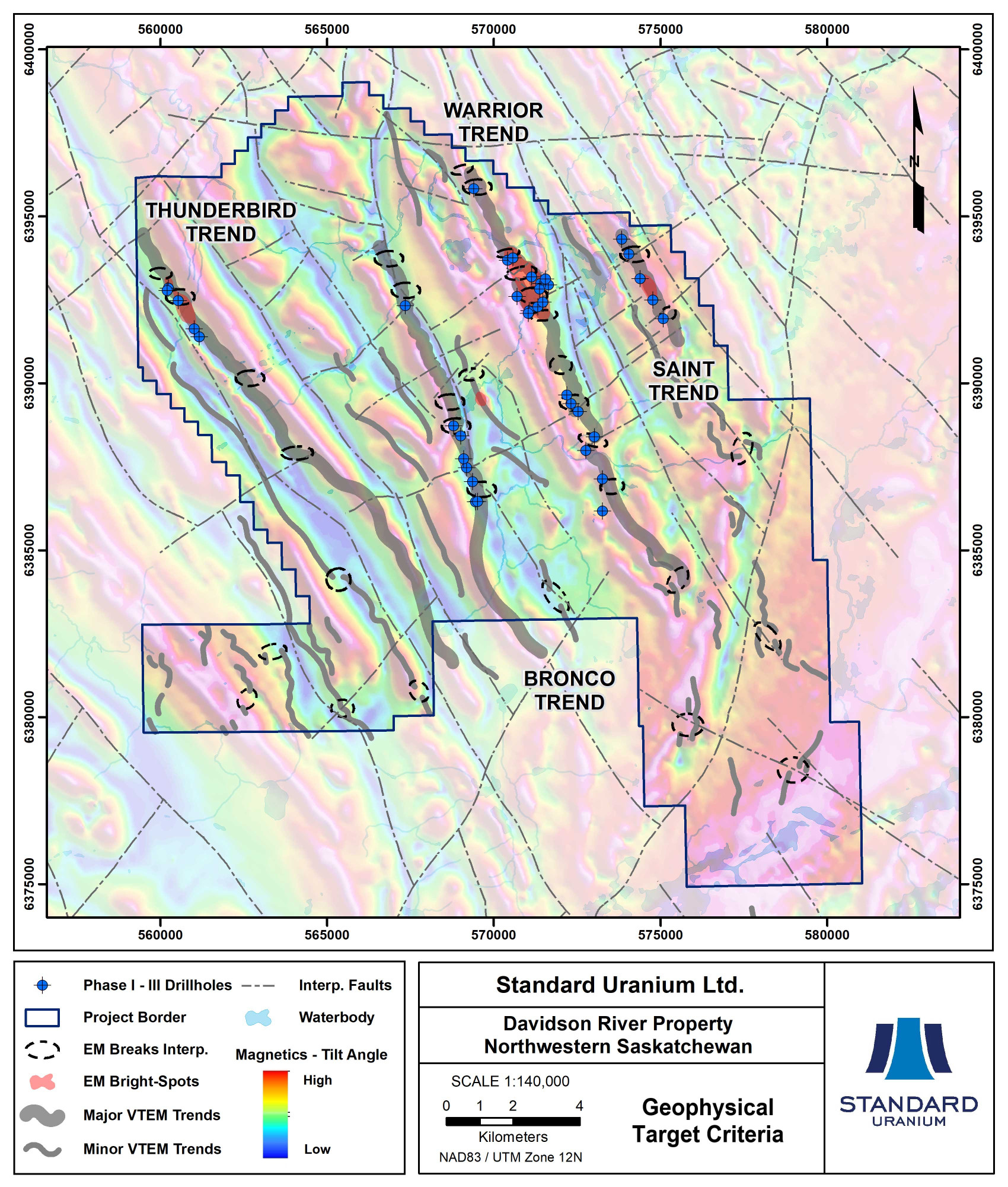
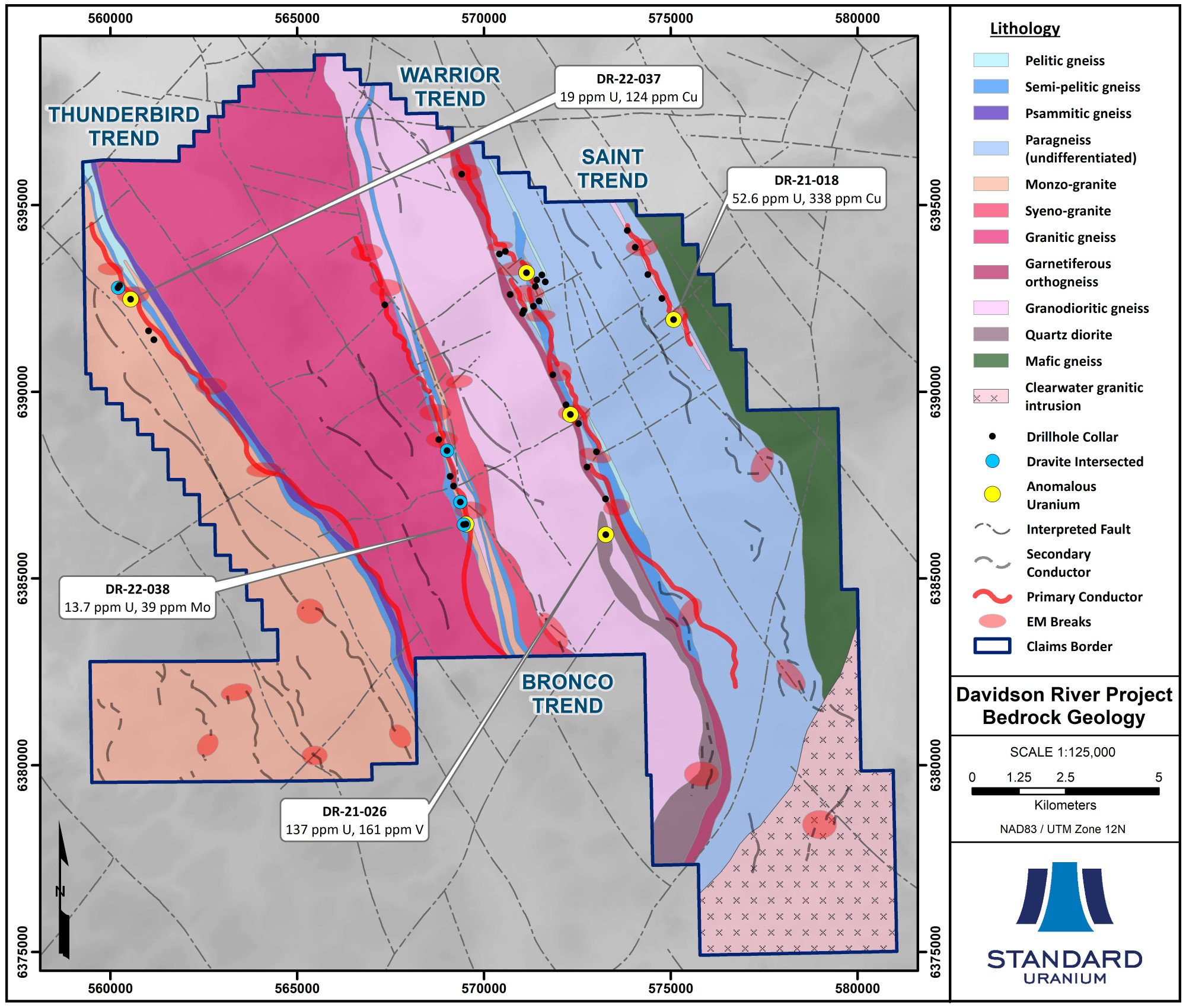
Davidson River comprises 10 contiguous mineral dispositions totaling 30,737 hectares and lies approximately 25 to 30 km west of the Arrow and Triple R uranium deposits and 75 km south of the past-producing Cluff Lake uranium mine. The Company has completed 16,561 metres of diamond drilling in 39 drill holes on the Davidson River property since 2020, which has further refined the exploration strategy for high-grade basement hosted uranium mineralization on the property. The flagship property hosts more than 70 km of conductive trends across four main structural corridors – the Warrior, Bronco, Thunderbird, and Saint trends (Figure 1). All four geophysical corridors contain multiple target areas favorable for high-grade basement hosted uranium mineralization.
Figure 1. Geophysical Target Criteria

In 2018 and 2019, the Company conducted geophysical surveys that identified prospective signatures for uranium mineralization associated with the four main conductive corridors. These conductive trends are associated with graphitic-sulphidic structures in basement rocks, which are commonly associated with high-grade uranium mineralization systems. This concept has been proven for all four corridors, with several instances of graphitic-sulphidic fault rocks and reactivated structures intersected along the tested strike length.
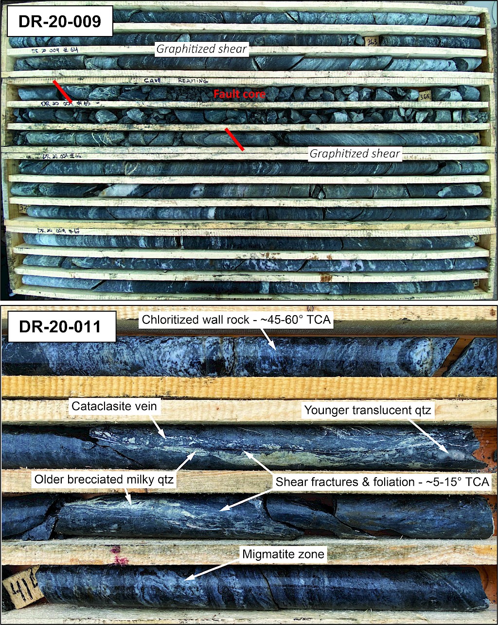
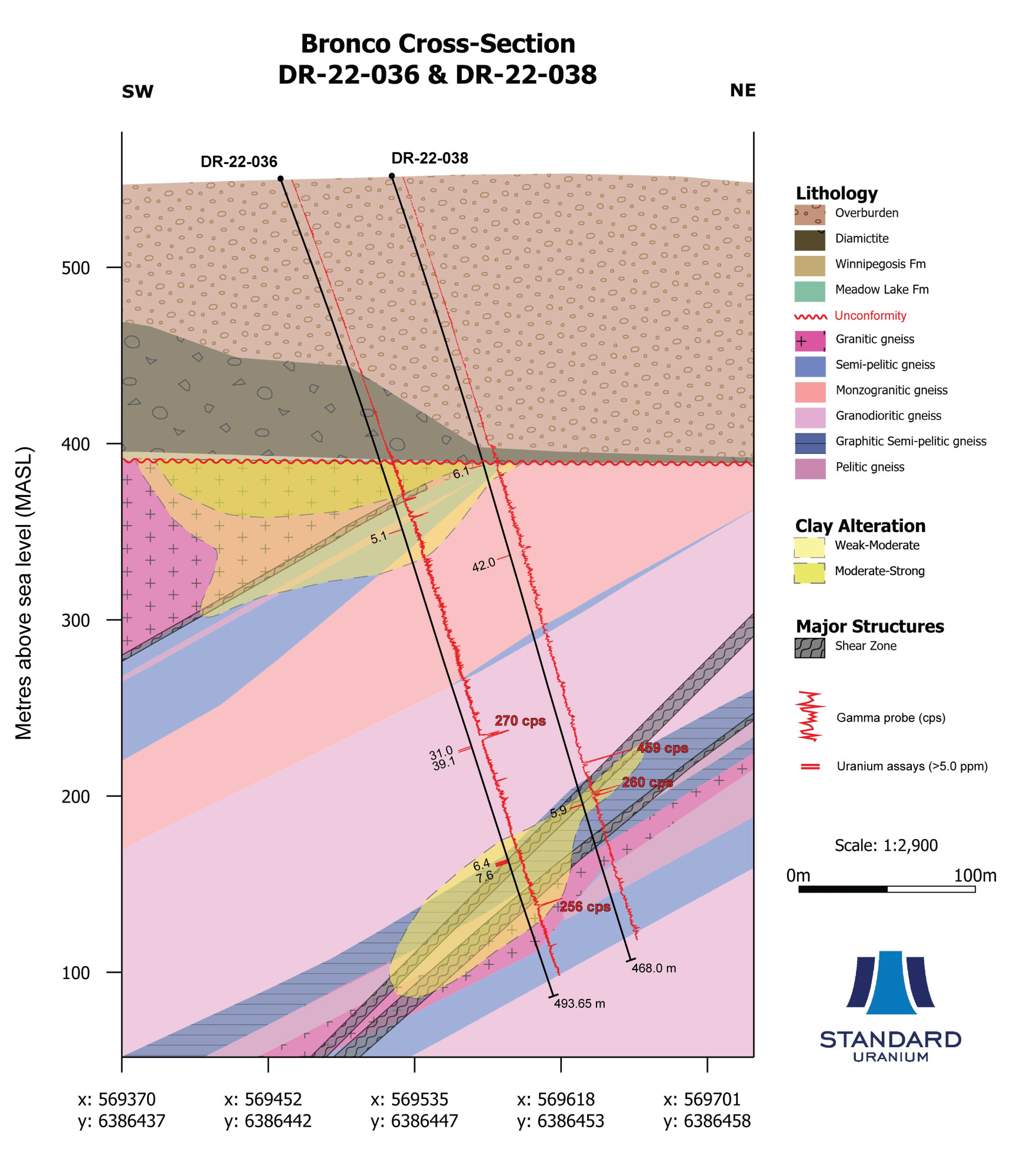
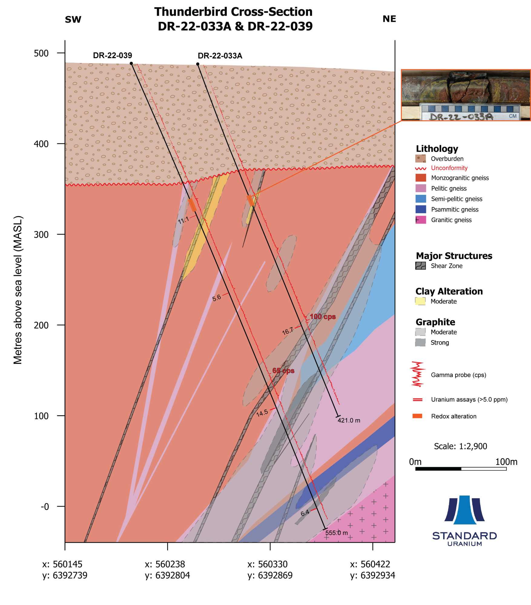
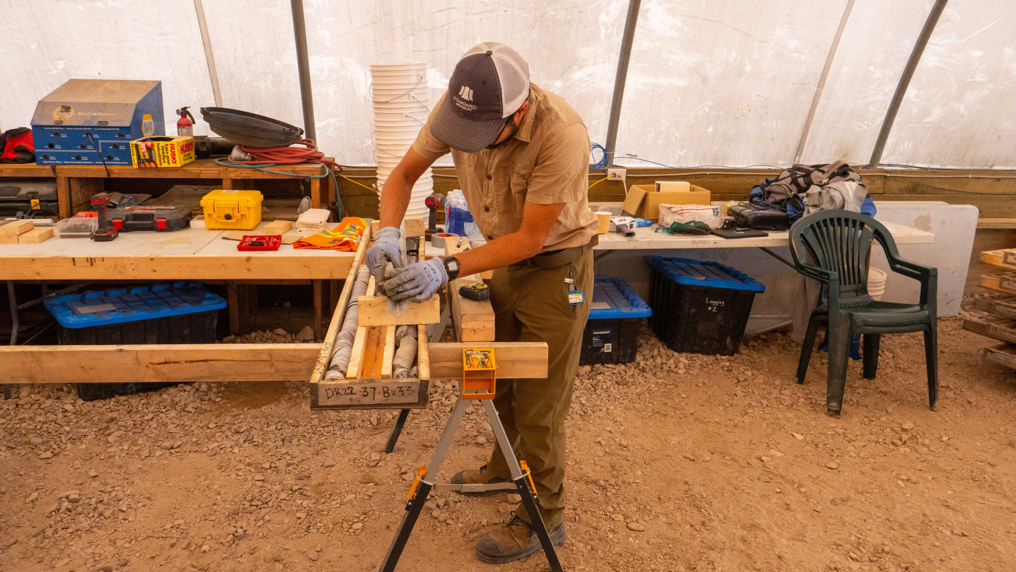
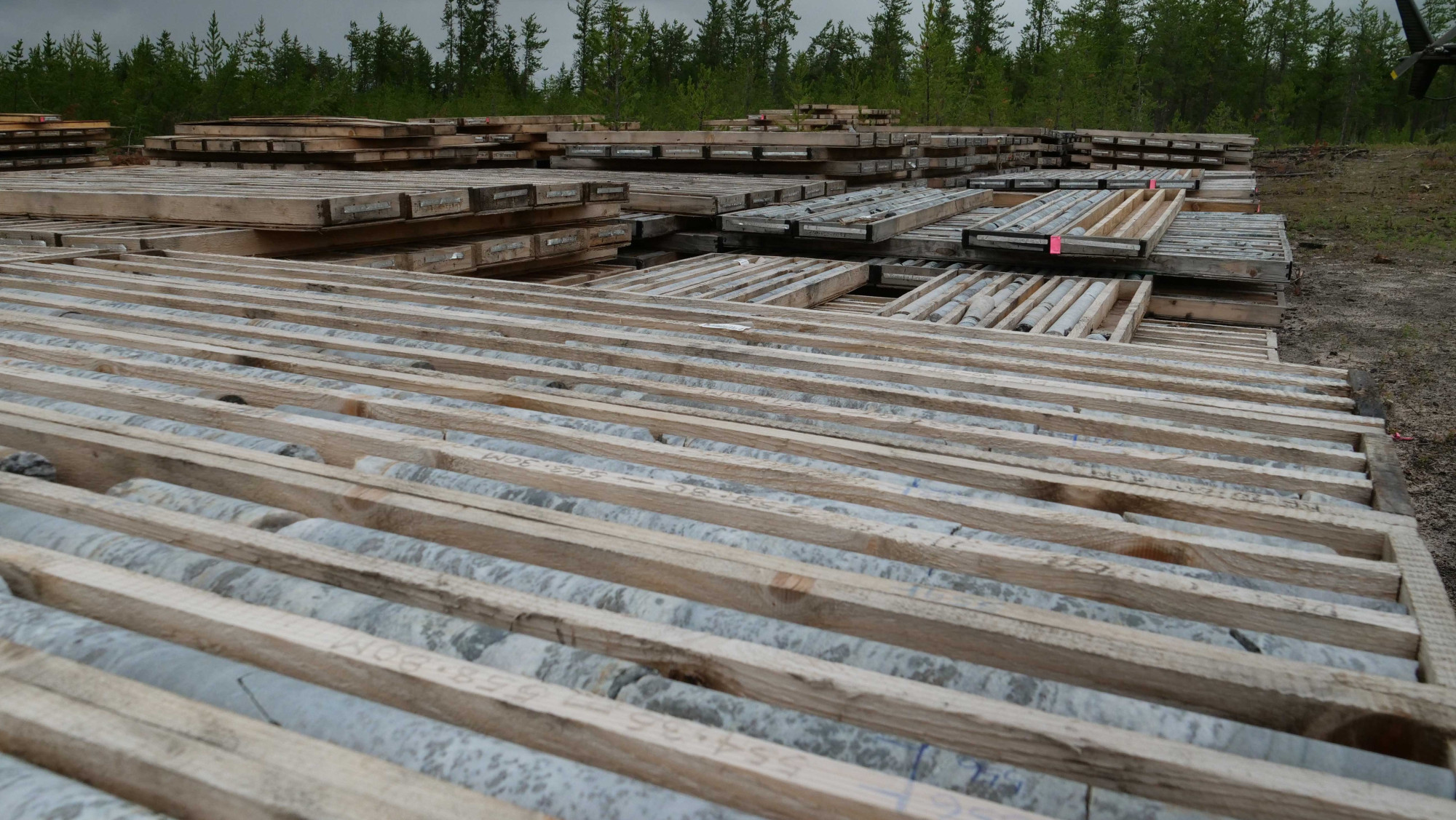
Favorable basement rock types and alteration phases have been observed across the strike length of the main trends, resembling those which host other uranium deposits in the southwestern Athabasca Basin region. Key indicators include clay-dravite alteration and stacked lenses of variably strained graphite and sulphide-bearing garnetiferous gneisses and altered feldspar-rich rocks. Elevated uranium values in the basement rocks are dominantly associated with deformed metasedimentary units and coarse-grained pegmatites. Structural zones in the basement are locally associated with elevated uranium and/or boron values (over 1,000 ppm B), such as in DR-20-009 and -011 (Photo 1).
Photo 1
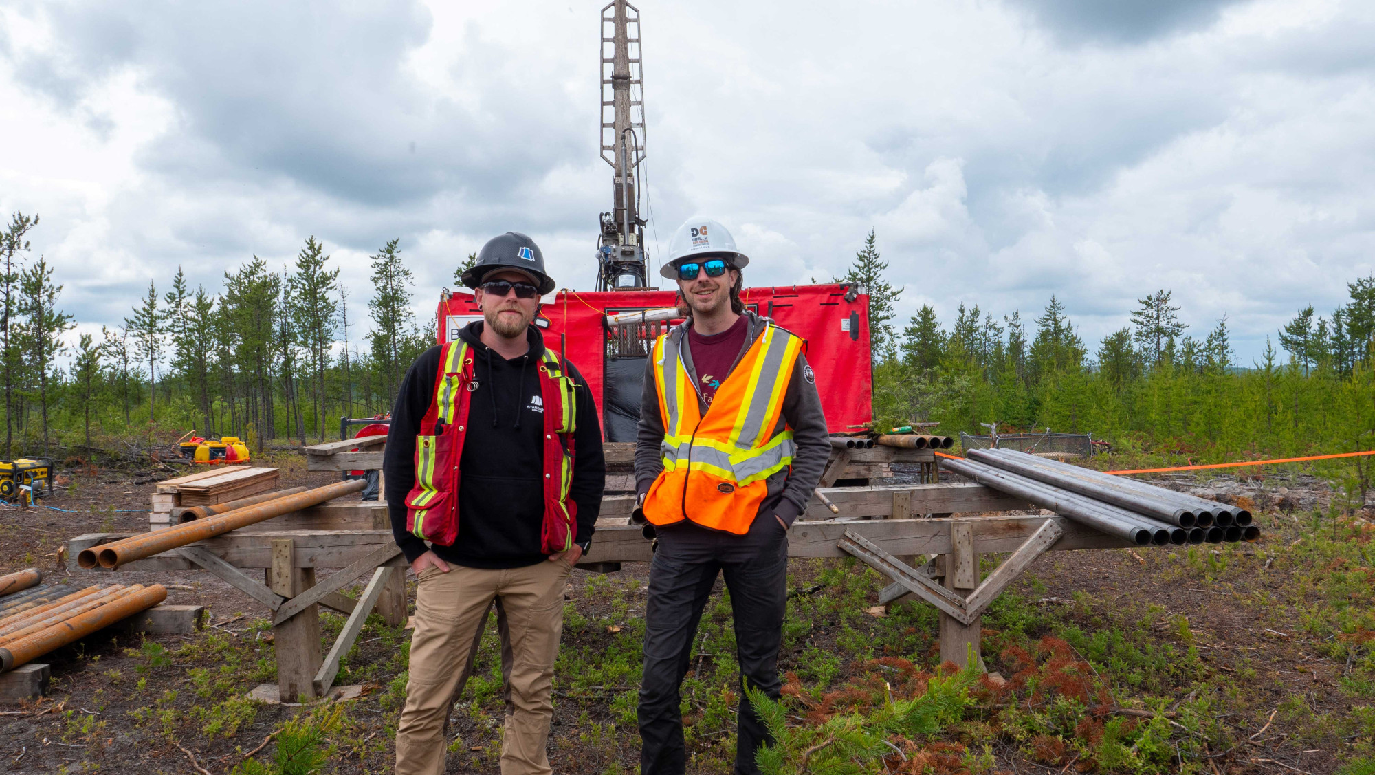
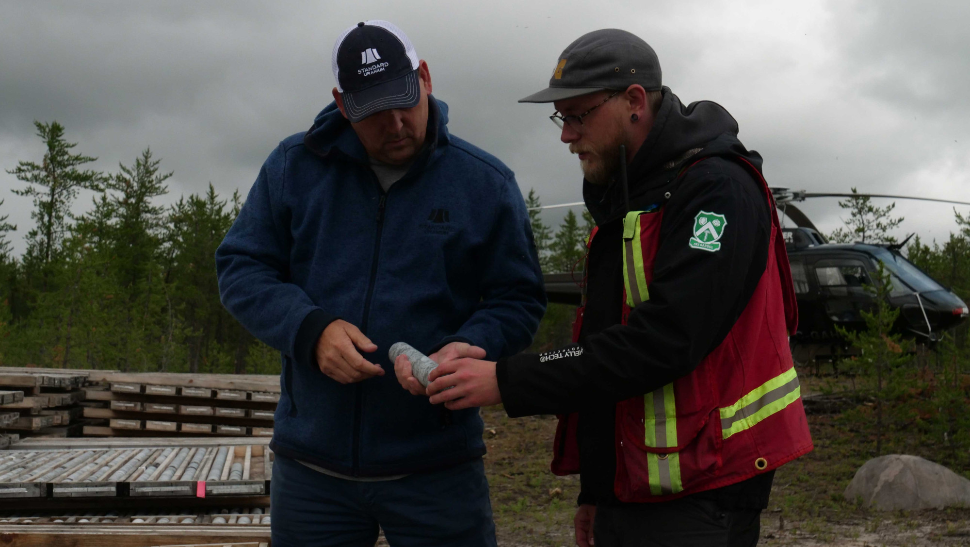
The results from the 2020-2022 diamond drilling programs highlight the potential for the Davidson River property to host significant basement hosted unconformity-related uranium mineralization, and the property contains several priority targets along all four trends that warrant further exploration. Target areas on the property have been identified to follow up on major graphitic-sulphidic basement structures and anomalous geochemical signatures. The project and drill core storage can be accessed via the Davidson River access trail from Highway 955.
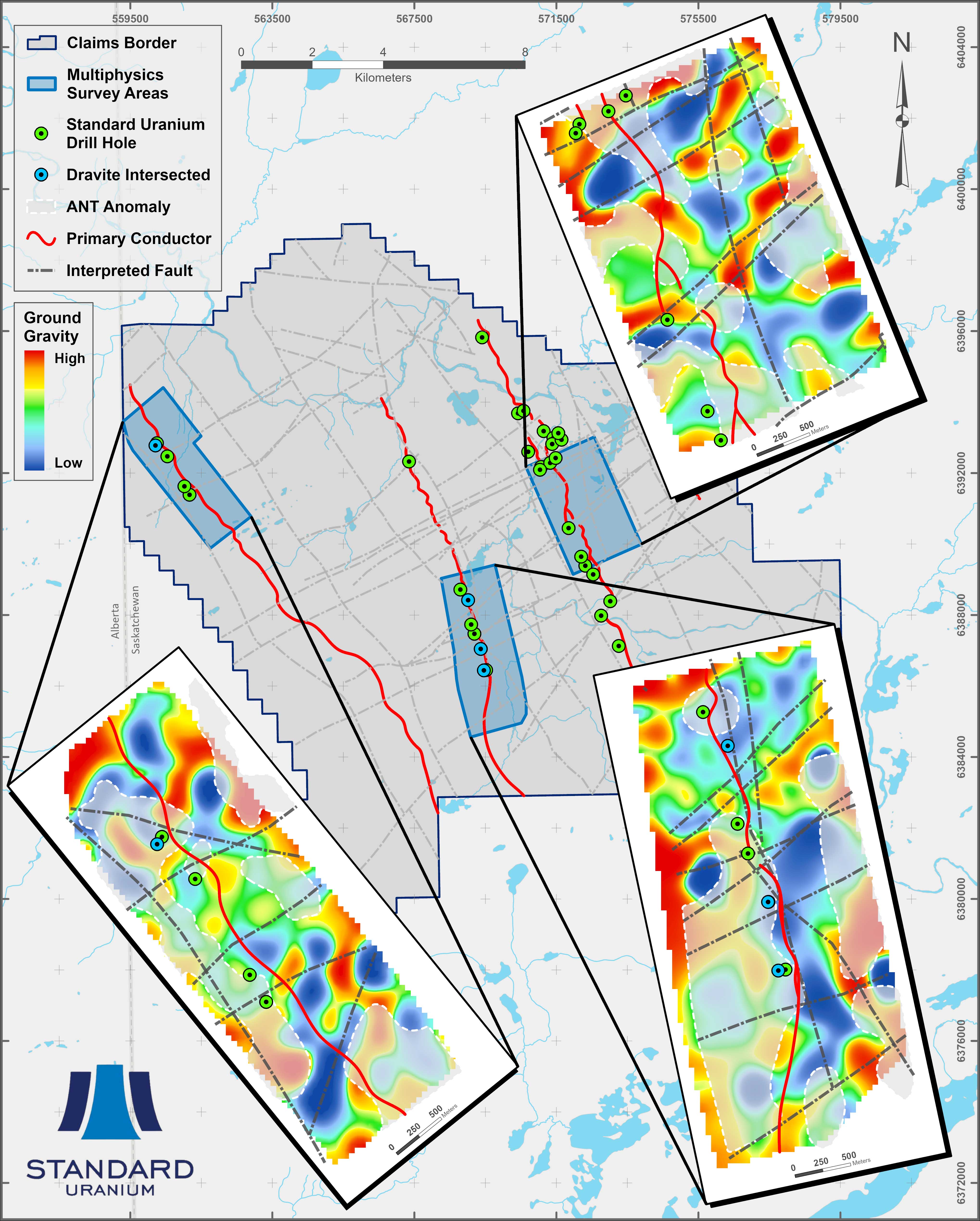
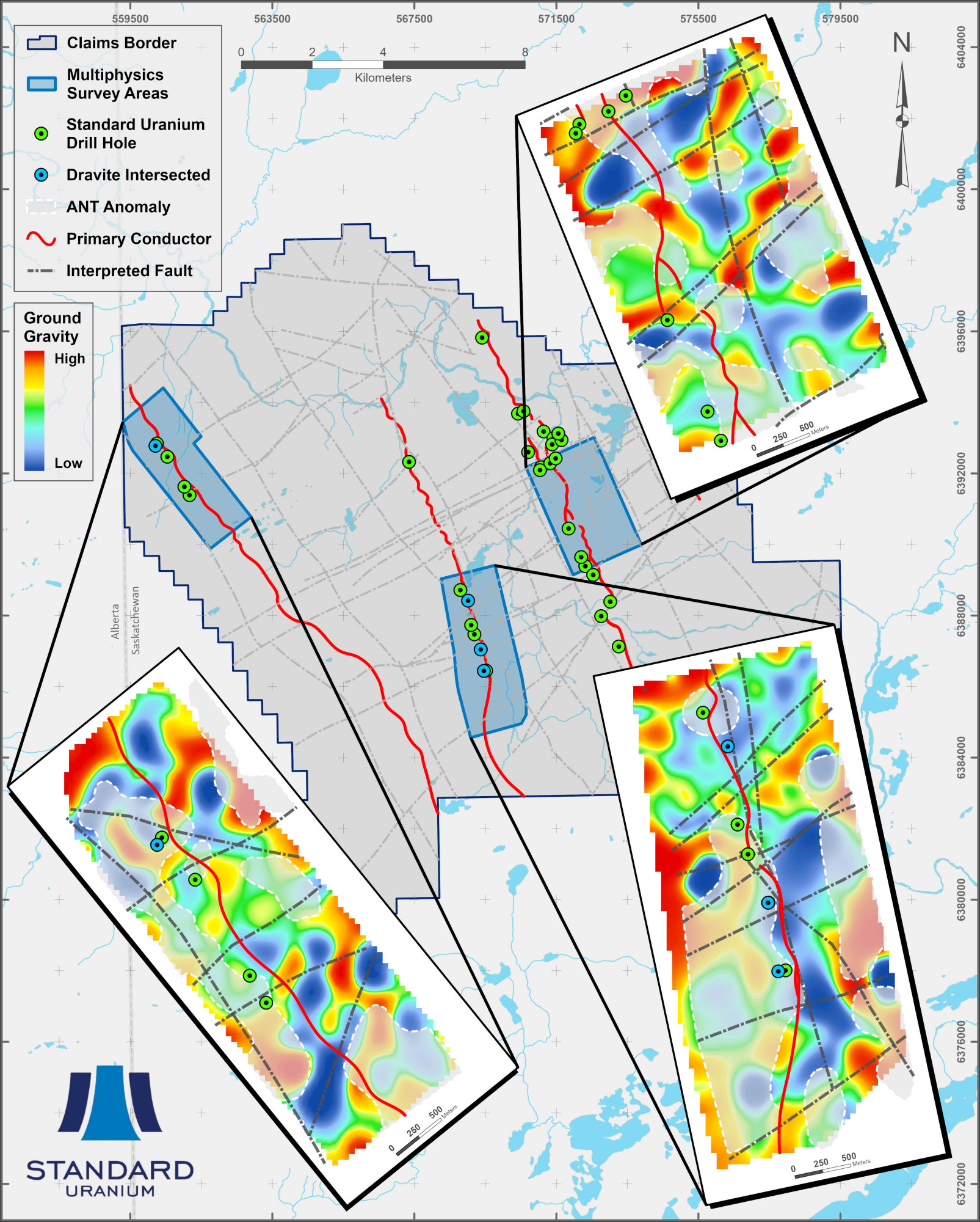
In 2025, the Company successfully completed the first ExoSphere Multiphysics surveys in the southwest Athabasca Basin region on Davidson River, outlining multiple highly prospective target areas across the Warrior, Bronco, and Thunderbird conductor corridors. The surveys combined 3D Ambient Noise Tomography (“ANT”) and Horizontal-to-Vertical Spectral Ratio (“HVSR”) velocity models and constrained 3D density block models have been generated on the Warrior, Bronco, and Thunderbird trends (Figure 2), providing critical subsurface information for guiding ongoing exploration across the Project. Distinct density-low anomalies representing potential hydrothermal alteration zones have been identified across all three surveyed structural corridors, overlapping known electromagnetic (“EM”) conductors, extrapolated basement faults from previous drilling, and basement velocity lows marking structural disruption and/or favorable lithological contrasts. Multiple new targets also coincide with EM SmartMatch targets provided by ALS GoldSpot based on machine learning anomaly-matching to the neighbouring Arrow and Triple R deposits.
Figure 2 - Multiphysics Survey Results
Disclosure of Technical and Scientific Information
Except as otherwise noted herein, Sean Hillacre, MSc. P.Geo., Standard Uranium’s VP Exploration, has reviewed and approved the scientific and technical information contained in this website. Mr. Hillacre is a Qualified Person within the meaning of Canadian Securities Administrator’s National Instrument 43-101.
Location & Infrastructure
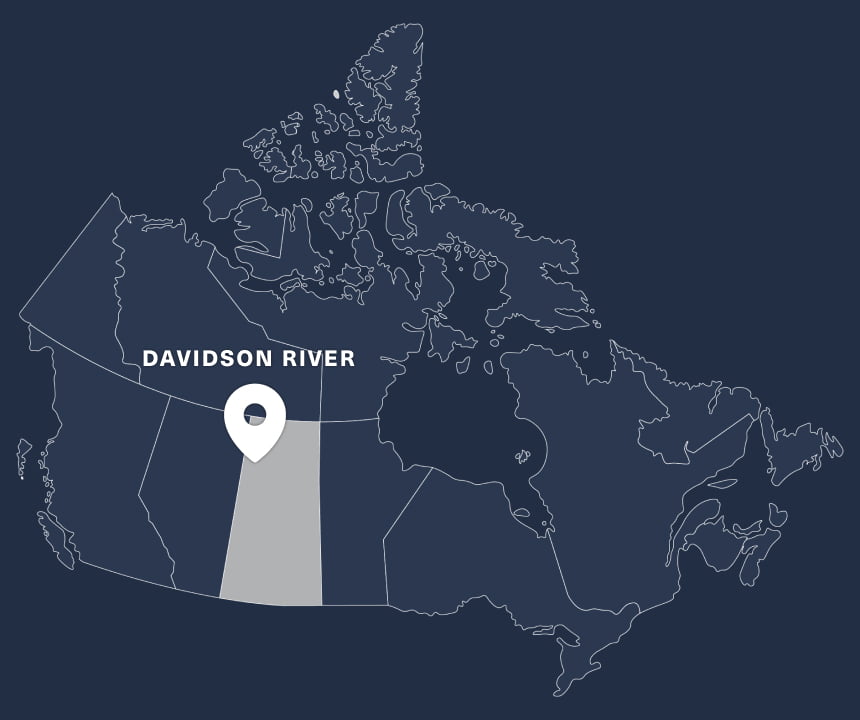
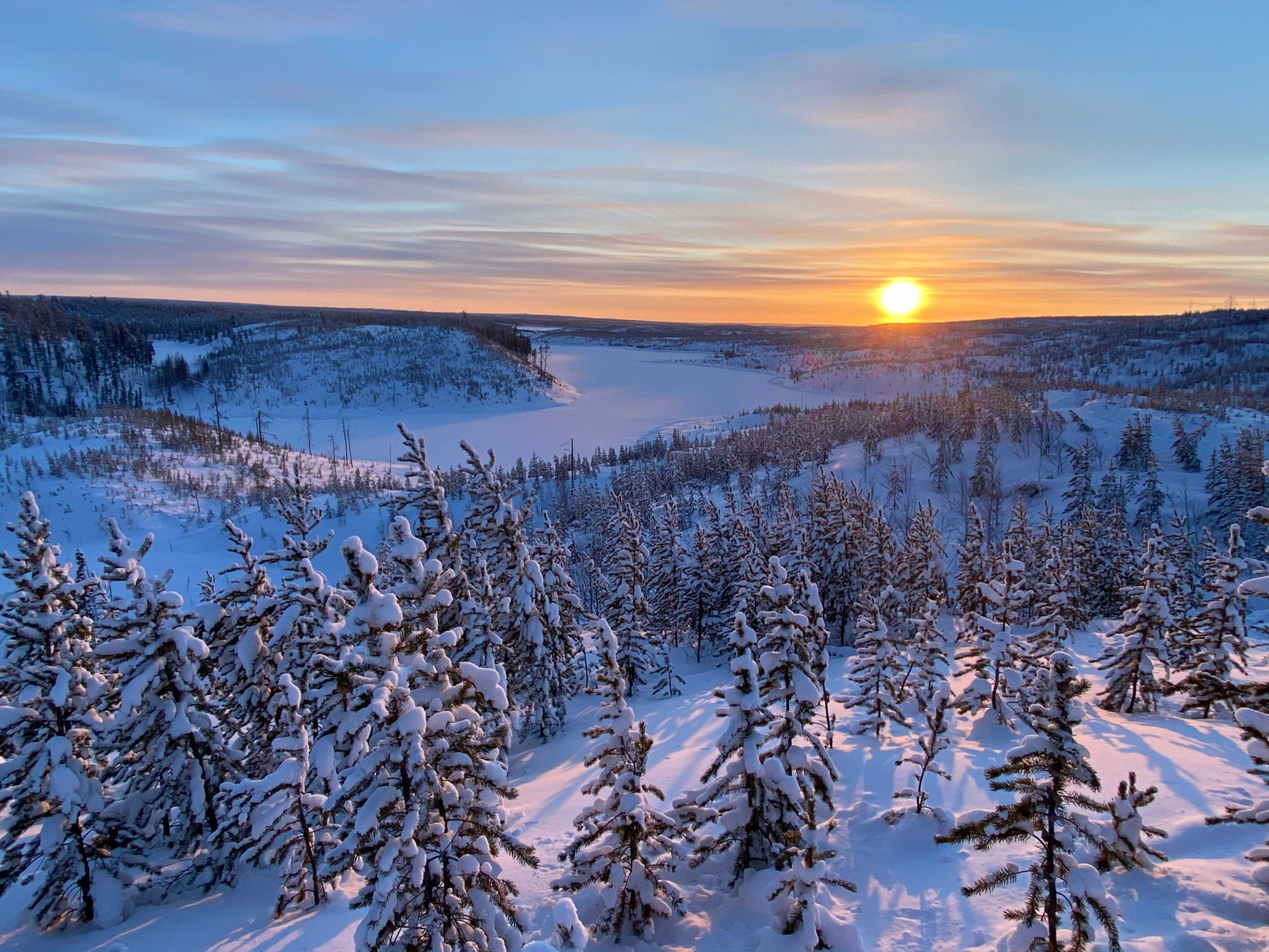
The Davidson River Property is in northwestern Saskatchewan, approximately 125 kilometres north of the village of La Loche and approximately 645 km north-northwest of Saskatoon, the largest city in Saskatchewan (Figure 1). The Project is bound to the west by the Alberta-Saskatchewan border and is centred at roughly 568,000 m east and 6,390,600 m north, Universal Transverse Mercator ("UTM") projected coordinate system using North American Datum 1983 (“NAD83”), Zone 12N, and occupies a portion of 1:50,000 scale National Topographic System (“NTS”) index map sheets 74F/12.
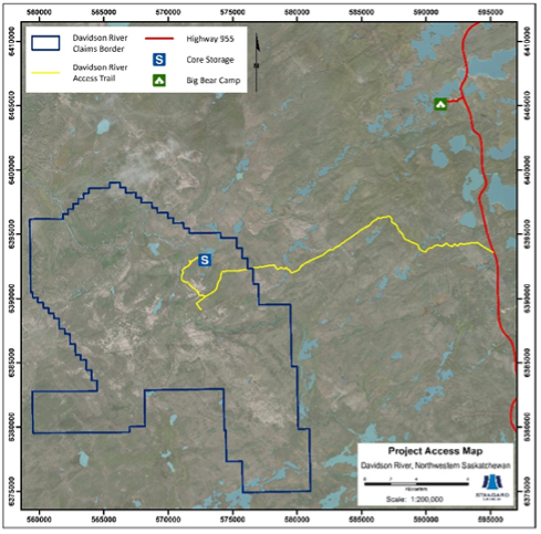
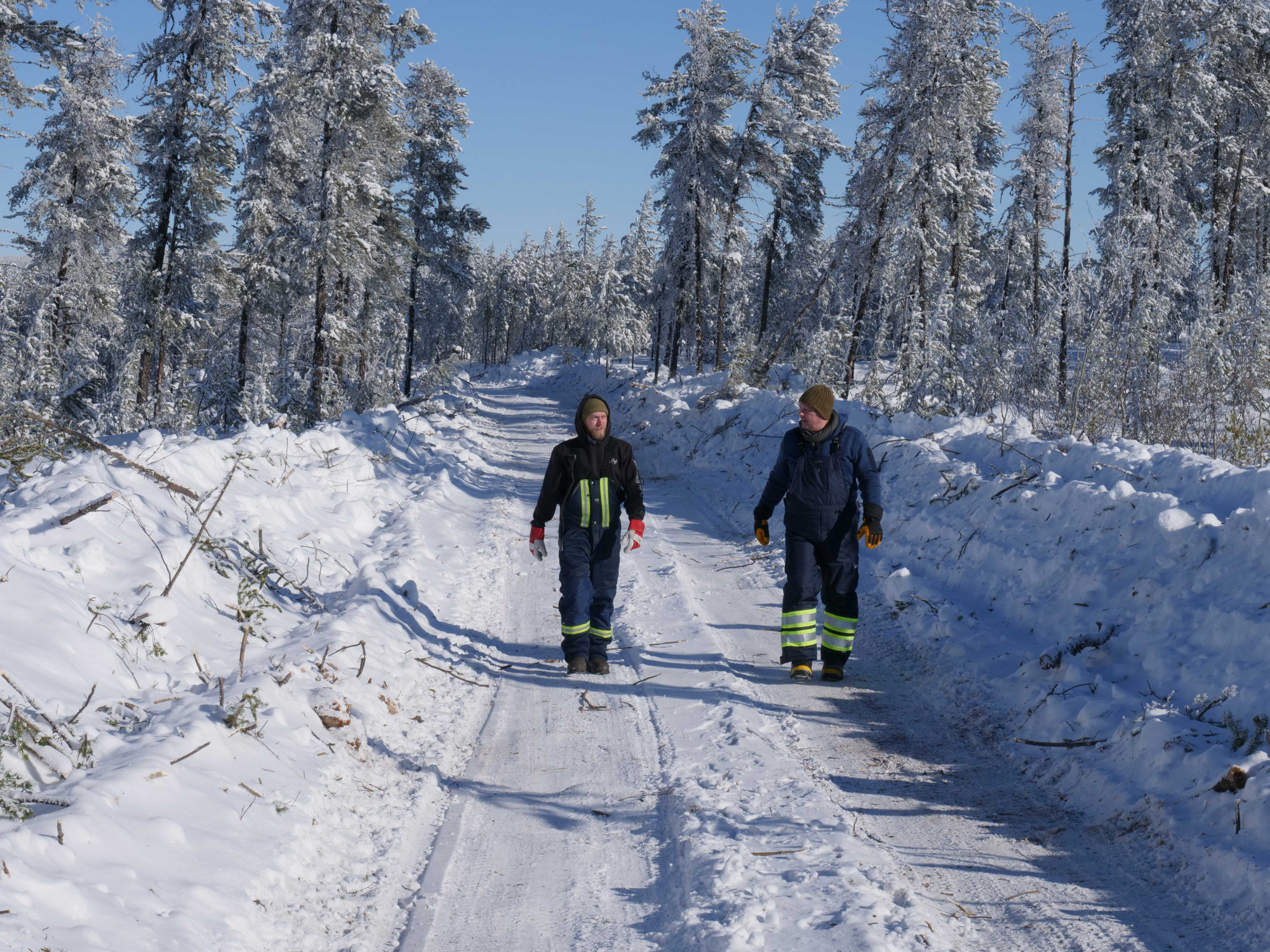
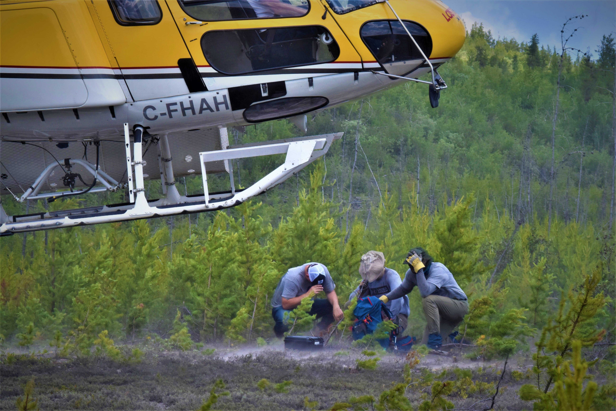
The Project is accessible in summer via helicopter and a temporary access trail, providing access from the Cluff Lake gravel highway (955), which lies 15 km east of the Project (Figure 2). The nearest air base is in Fort McMurray, Alberta, approximately 135 km southwest of the Project and can be reached within approximately 45 minutes by helicopter.
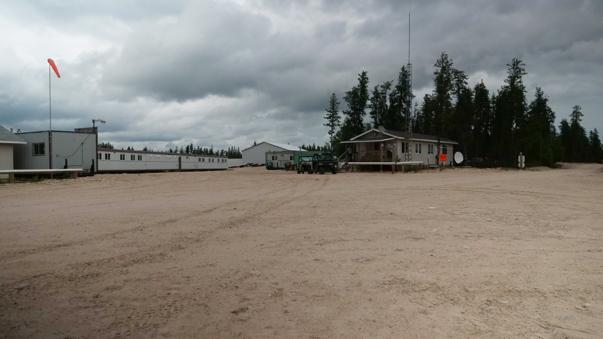
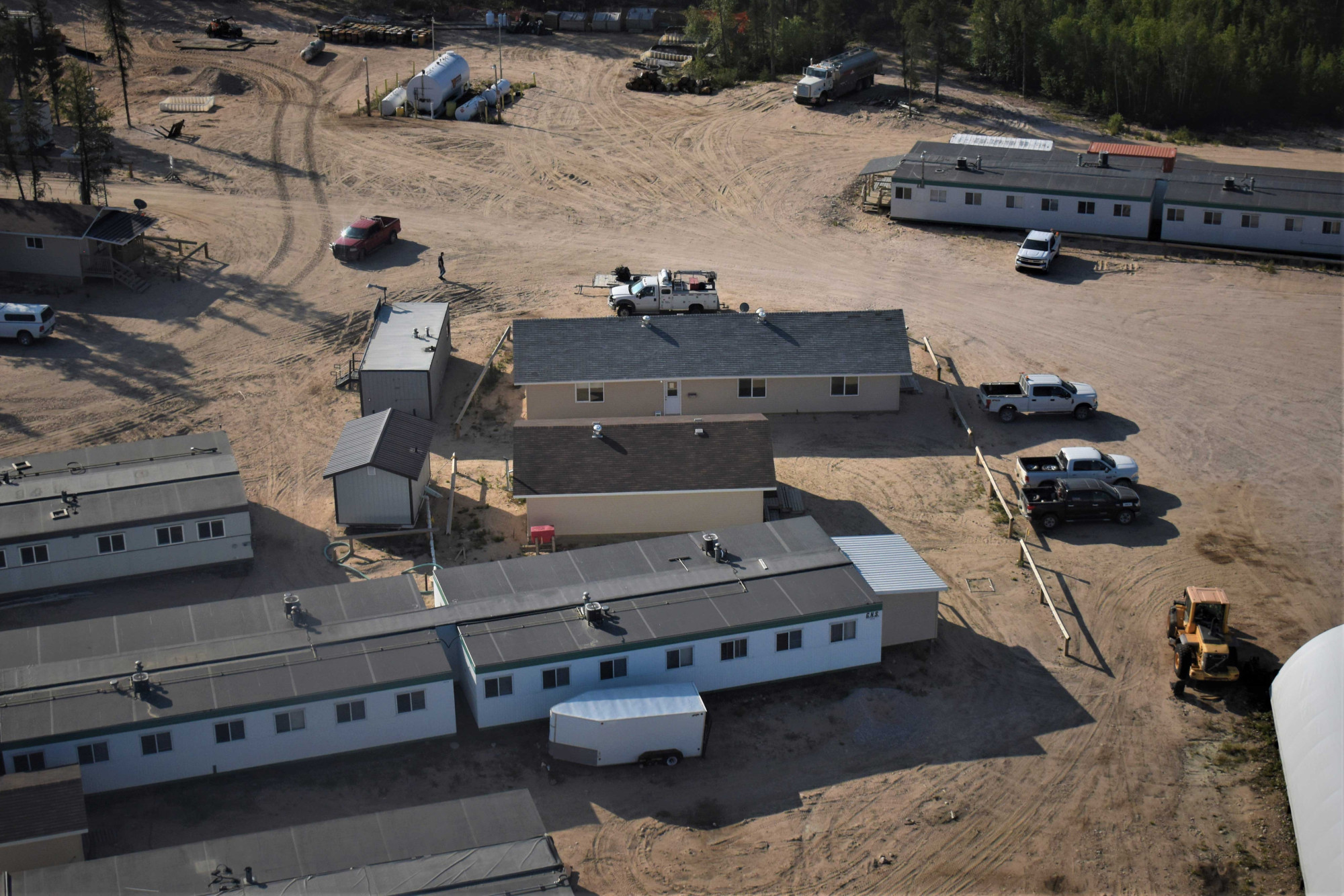
Apart from Highway 955, no major infrastructure exists in the Davidson River area. Services and supplies are primarily obtained through the village of La Loche, the closest population centre in Saskatchewan with adequate infrastructure and local resources. Big Bear Lodge, located on the southwestern edge of Grygar Lake, is approximately 19 km northeast of the Davidson River claim boundary and is used as the primary camp exploration activities. The Big Bear Lodge is accessible via a small access road connected to Highway 955 at approximately km 175 north of La Loche.
Ongoing development of the neighbouring Arrow and Triple R deposits by NexGen and Paladin Energy, respectively, will significantly expand infrastructure in the area with the construction of new mine and mill infrastructure.
Figure 1. Regional Project Location
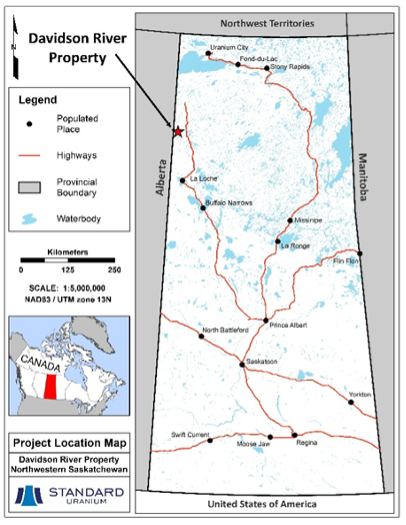
Figure 2. Project Access
